Bet Guvrin-Maresha is an archaeological park, that encompasses the ancient sites of Maresha, Bet Guvrin (also called Eleutheropolis and Beth Gabra), and a crusader fortress, located in the heart of the Judean lowlands of central Israel.
The region was initially centred on the biblical Iron Age settlement of Maresha, emerging as a major Idumean city, and one of the cities of Judah during the time of the First Temple.
After a six-year Macedonian conquest of the empire of Darius III of Persia by Alexander the Great, Maresha was colonised by retired Greek soldiers, Sidonians and Nabataeans, and placed under Hellenistic rule.
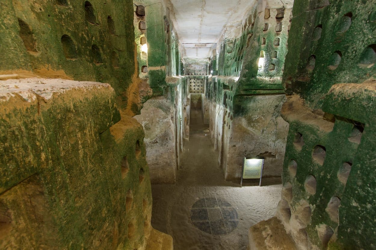
Archaeological studies of Maresha and the surrounding area has uncovered a labyrinth of subterranean caves numbering over 500 caves sites, containing some 3,500 rooms that extend over an area of 741 acres. Most of the caves date from the Hellenistic period, and served as quarries, cisterns, storerooms, dovecotes, tombs, storage chambers, ornate burial chambers with niches, and shelters for farm animals.

Maresha was destroyed in 40 BC by the Parthians, leading to the neighbouring Idumean/Jewish town of Bet Guvrin succeeding as the main settlement.
The First Jewish Revolt against Roman rule in AD 66 resulted in Vespasian slaughtering or enslaving the inhabitants of Bet Guvrin, which according to the first-century Romano-Jewish historian, Titus Flavius Josephus stating “When he had seized upon two villages, which were in the very midst of Idumea, Betaris, and Caphartobas, he slew above ten thousand of the people, and carried into captivity above a thousand, and drove away the rest of the multitude, and placed no small part of his own forces in them, who overran and laid waste the whole mountainous country.”
In AD 200, Emperor Septimus Severus granted Bet Guvrin the status of a polis city, and changed its name to Eleutheropolis (“city of the freedmen”). The Roman city became an important administrative centre, serving as the central point from which the distances of other towns in the region were measured. A depiction of Bet Guvrin in the Byzantine Madaba Map (dated AD 542-570) shows Eleutheropolis as a walled city with three towers, a curving street with a colonnade, and a large basilica.

In the early 7th century AD, Bet Guvrin was conquered by Muslim forces led by ‘Amr ibn al-‘As. The city was then annexed into the Kingdom of Jerusalem and fortified with the construction of the crusader castle of Bayt Jibrin around AD 1134.
The Ayyubid army under Saladin sacked Bet Guvrin in AD 1187, after most of the Kingdom of Jerusalem came under Muslim control as a consequence of his victory at the Battle of Hittin. Soon after its capture, Saladin ordered the demolition of the Crusader castle.
Header Image : A columbarium cave (dovecote) Image Credit : Suprun Vitaly – Shutterstock


